Sunderland LPA BNG
Discover key habitats, BNG requirements, and planning guidance for developers in Sunderland LPA Local Planning Authority.

.avif)
Trusted by Developers and Landowners


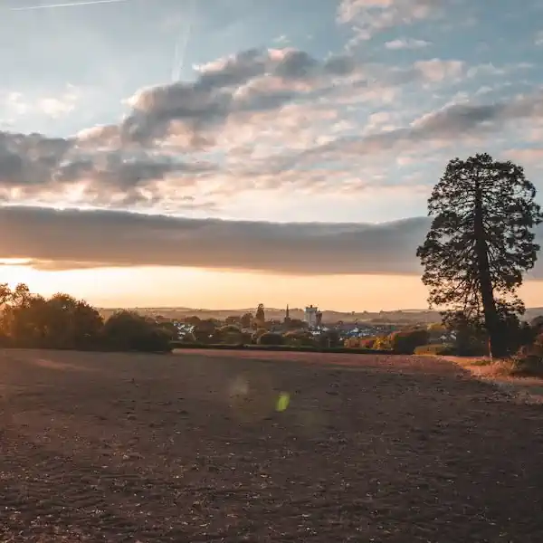
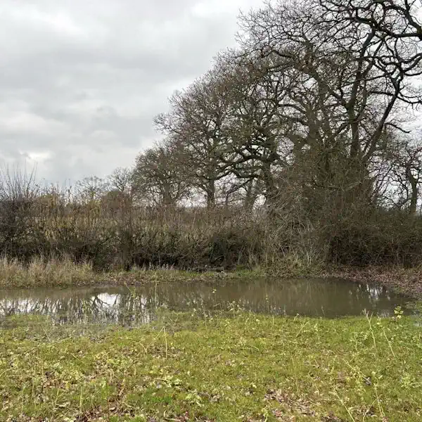
Biodiversity Net Gain in Sunderland LPA Local Planning Authority
West Berkshire, located in South East England, is a predominantly rural Local Planning Authority (LPA) known for its diverse natural environment and rich ecological heritage. Covering an area of approximately 704 square kilometres, the district includes a range of urban centres and rural settlements, with Newbury serving as the principal town. Other significant towns and villages within the LPA include Thatcham, Hungerford, Pangbourne, and Theale, each contributing to the area's distinctive landscape character and biodiversity value.
As part of its commitment to sustainable development, West Berkshire Council actively supports the implementation of Biodiversity Net Gain (BNG) in line with the Environment Act 2021. Developers working within the LPA are required to deliver a minimum 10% net gain in biodiversity value for most developments, secured through habitat creation, enhancement, or approved off-site units.
West Berkshire encompasses several National Character Areas (NCAs), notably the North Wessex Downs and Thames Basin Heaths, each influencing the typical habitat types found in the region. These include ancient woodlands, chalk grasslands, river valleys, lowland mixed deciduous woodlands, and floodplain meadows—many of which are priority habitats under the UK Biodiversity Action Plan. This ecological diversity presents both opportunities and constraints for BNG delivery, requiring careful ecological assessment and strategic planning.
For developers, landowners, and planners operating within West Berkshire, understanding the LPA’s landscape, habitat distribution, and regional policy context is critical to meeting BNG obligations. Our team provides tailored support through BNG assessments, habitat mapping, and access to verified local BNG units and schemes.
To learn more about BNG opportunities in this area, contact us or register to be notified when local schemes become available.
Sunderland, a unitary authority in North East England, spans a diverse mix of urban centres, river valleys, coastal habitats, and rural landscapes. Covering approximately 137 square kilometres, the city includes the urban core of Sunderland, as well as the towns and villages of Washington, Houghton-le-Spring, and Hetton-le-Hole. The city is defined by key natural features including the River Wear, the North Sea coastline, and a network of green wedges and country parks.
Sunderland City Council supports the mandatory implementation of Biodiversity Net Gain (BNG) under the Environment Act 2021. A minimum 10% increase in biodiversity value is required for most developments, to be achieved through habitat creation, restoration, or delivery via recognised off-site units. The Council has aligned BNG delivery with its Local Plan, green infrastructure strategy, and climate resilience priorities, recognising the importance of biodiversity to environmental quality, public health, and ecological connectivity.
The borough is predominantly located within the Tyne and Wear Lowlands National Character Area, with southern areas influenced by the Durham Magnesian Limestone Plateau. This landscape supports a range of important habitats including limestone grassland, coastal cliffs, estuarine systems, and urban greenspace. Several priority habitats under the UK Biodiversity Action Plan are present within Sunderland, offering both opportunities and constraints for BNG planning.
Developers, planners, and landowners working in Sunderland are encouraged to understand local habitat distinctiveness, landscape-scale opportunities, and long-term management requirements. Our team provides support through baseline surveys, metric calculations, and access to emerging biodiversity offset sites across the region.
To find out more about BNG opportunities and local schemes in Sunderland, contact us or register for updates.
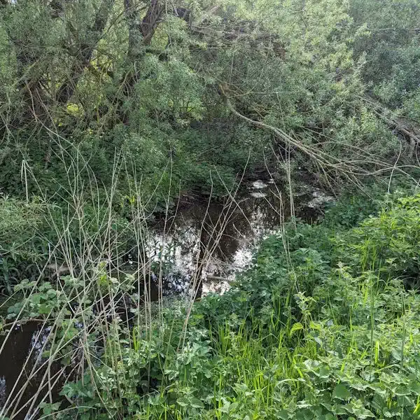
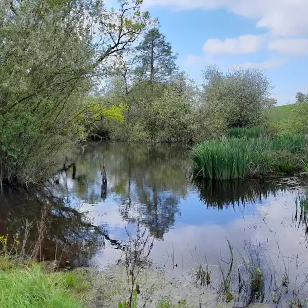
Habitats in Sunderland LPA Local Planning Authority
.avif)
West Berkshire’s landscape is shaped predominantly by the North Wessex Downs National Character Area (NCA 116), a chalk downland landscape of international ecological importance, and partly by the Thames Basin Heaths (NCA 129). These NCAs support a rich mosaic of habitats, many of which are priority habitats under BNG classifications and the UK Biodiversity Action Plan.
Grassland Habitats
Lowland calcareous grassland dominates the chalk ridge areas, supporting diverse plant species like orchids and wild thyme.
Lowland meadows are scattered along the Kennet Valley and floodplain, offering high biodiversity value, particularly for invertebrates and ground-nesting birds.
Areas of modified grassland are common in improved pastures and paddocks, but these hold lower BNG value unless enhanced.
In some acidic soils, lowland dry acid grassland and other lowland acid grassland can be found, especially on sandy substrates and heathland edges.
Woodland and Forest Habitats
The LPA contains extensive lowland mixed deciduous woodland, particularly on the clay-with-flints plateau and valley slopes, providing habitat for bats, dormice, and woodland birds.
Veteran trees and old estates feature wood-pasture and parkland, a rare and highly valued BNG habitat.
Areas of wet woodland, often associated with river valleys, add to the ecological complexity.
Heathland and Shrub
On the fringes of the Thames Basin Heaths, lowland heathland and mixed scrub are present, though often fragmented, supporting heathland birds like nightjar and Dartford warbler.
Wetland and Watercourse Habitats
The River Kennet, a designated Site of Special Scientific Interest (SSSI), provides priority river habitats and supports adjacent floodplain wetland mosaics.
Smaller ponds, reedbeds, and ditches are scattered across the landscape, particularly in floodplain areas.
Cropland Habitats
Much of West Berkshire’s agricultural land is under cereal crops or temporary grass and clover leys, but there is increasing scope to integrate arable field margins for biodiversity gain.
Hedgerows and Linear Features
The rural landscape is strongly characterised by native species-rich hedgerows, often associated with ditches and banks, which function as critical wildlife corridors under BNG classification.
Sunderland’s ecological character is shaped by its river valley, coastal setting, and reclaimed industrial landscapes.
Coastal and Estuarine Habitats
The Sunderland coastline features maritime cliffs, sandy bays, and dune systems supporting seabirds and coastal flora.
Estuarine habitats along the mouth of the River Wear include mudflats, reedbeds, and saltmarsh, providing important feeding and roosting grounds for birds.
Coastal grasslands atop cliffs are species-rich and vulnerable to erosion and recreational pressure.
Grassland Habitats
Magnesian limestone grassland, a high distinctiveness habitat, is found in southern parts of the borough, particularly in designated sites such as Tunstall Hills and Fulwell Quarry.
Improved grassland dominates parks, road verges, and playing fields, with increasing conversion to species-rich swards.
Neutral and marshy grassland occur in floodplains and fringe areas.
Woodland and Scrub Habitats
Lowland mixed deciduous woodland is found along the River Wear corridor, within urban parks, and in older estate landscapes.
Scrub and early successional woodland occur on brownfield land and reclaimed sites, offering value for invertebrates and birds.
Wetland and Watercourse Habitats
The River Wear, a key biodiversity asset, provides priority river habitat and is bordered by wet woodland, reedbeds, and rough grassland.
Ponds, swales, and SuDS features are found across urban developments and open spaces.
Wetlands such as those at Rainton Meadows and Herrington Country Park support amphibians and wetland bird species.
Brownfield and Urban Habitats
Former colliery and industrial land supports open mosaic habitats, often colonised by pioneer plant communities and used by ground-nesting birds.
Urban greenspace, while often of lower biodiversity value, presents practical opportunities for BNG interventions.
Hedgerows and Linear Features
Species-poor hedgerows are common in rural and peri-urban areas, though often fragmented.
Disused railway lines, greenways, and river corridors serve as wildlife movement routes with potential for enhancement.
Sunderland LPA BNG Planning
In Sunderland, high distinctiveness habitats such as magnesian limestone grassland, coastal cliffs, and estuarine wetlands are critical to retain, restore, or extend. These habitats are limited in extent and support rare plant and invertebrate species, requiring specialist management and longer-term ecological planning.
BNG can also be delivered through the enhancement of moderate to low distinctiveness habitats such as amenity grassland, scrub mosaics, and urban wetland features. Conversion to species-rich grassland, creation of ponds, reintroduction of native hedgerows, and woodland edge planting are viable strategies for achieving net gain. There is significant scope for integrating BNG into green infrastructure developments, sustainable drainage systems, and post-industrial regeneration projects.

Sunderland
Hendon
Millfield
East End
Pallion
Grangetown
Thornhill
Get notified of a scheme
We do not currently have any schemes covering this LPA.
Get notified when a scheme is available in this area.
Discover Schemes in
Sunderland LPA
LPA
Restoring ecosystems and creating sustainable habitats
through BNG and nutrient mitigation.
Somerset BNG Scheme
Trinity Farm & Eastcombe Fields
Tees Nutrient Mitigation
Tees Nutrient Mitigation Scheme
Kent BNG Scheme
Haffenden Habitat Bank
Test Valley BNG Scheme
Blackbarn Farm
Cheshire West and Chester BNG Scheme
Davenham Habitat Bank
High Weald BNG Scheme
Wilderlands Habitat Bank
Yare Nutrient Mitigation
Yare Nutrient Mitigation Scheme
Are you looking to start a BNG scheme?
Talk to Greenshank and explore the opportunities we offer through your land.
Latest News

Enhanced Drainage Ditch Management for Nutrient Transport Reduction
A review of Greenshank's Drainage Ditch Methodology for Nutrient Mitigation

Is the Levelling Up Bill heading up a creek without a paddle?
The quest for a greener, more sustainable future has led to remarkable innovations in technology.